


Windy with Scattered Rain & Storms from Francine
Flood Watch: Southwest & West TN from Thur AM to Sat. Morning
Forecast:
Today: Cloudy, Scat. Showers & Storms, A Few Storms May Be Strong
to Severe This Afternoon |High: 77| E 10-15, Gusts: 30 mph
Tonight: Windy, Area Showers & Storms, A Few Storms May Be
Strong to Severe |Low: 67 | E 15-20, Gusts: 30-40 mph
Tomorrow: Cloudy, Area Showers & Storms,Few Storms May Be
Strong to Severe |High: 78| SW 10-15, Gusts: 25 mph
In Depth:
Francine will move northward across Mississippi today. It'll continue
to weaken as it moves toward Memphis tonight. This track will bring
areas of rain and some thunderstorms to the Mid-South. While the
severe weather risk is low, a quick spin-up tornado is possible.

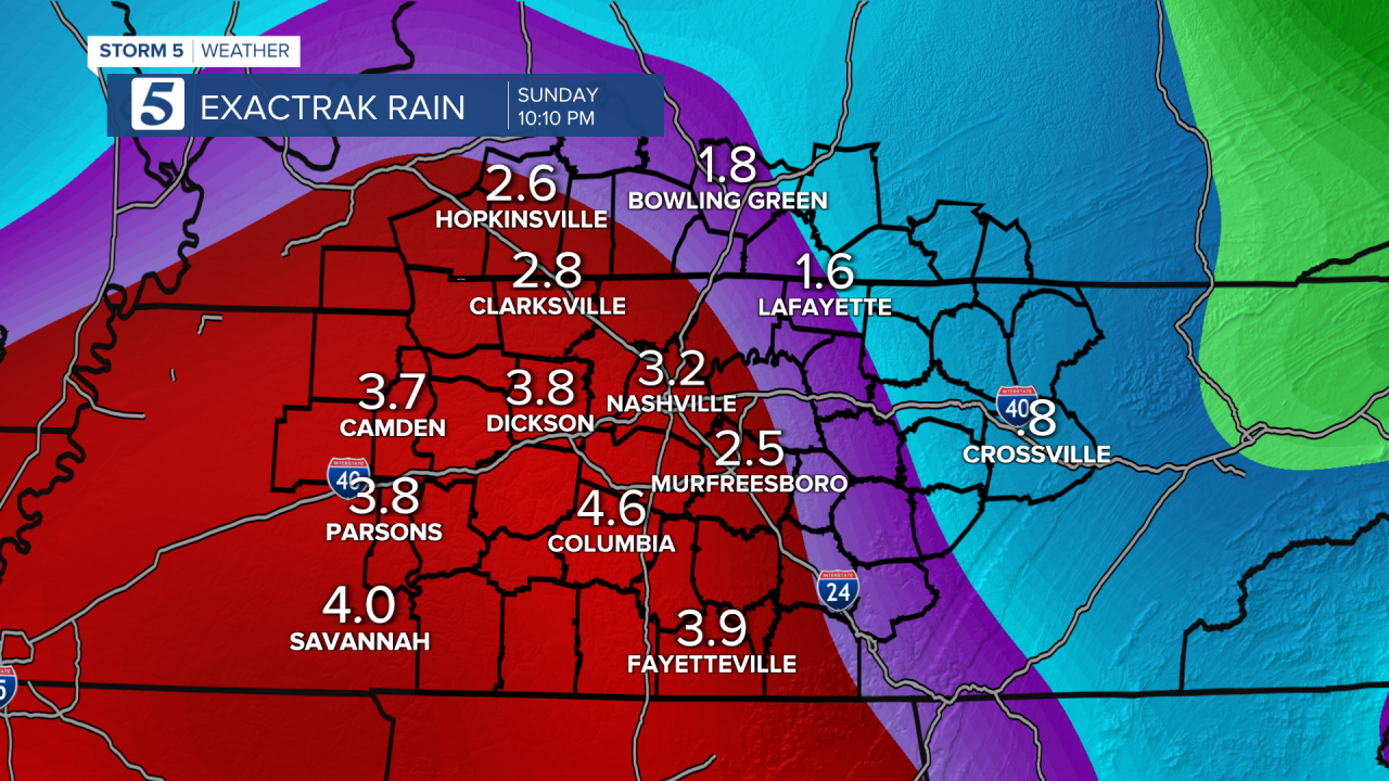
This will also bring heavy rain at times especially west of Nashville.
Rainfall amounts will rain from .5 to 1 inch along the Plateau to over
4 inches to the southwest of Nashville. Because of this, part of the region
is under a Flood Watch until Saturday morning.

The winds will also pick up, and wind gusts over 30-40 mph could lead
to spotty power outages.

