'Sweat'ember Continues
Forecast:
Tonight: Clear & Mild | Low: 7 | E 2-7
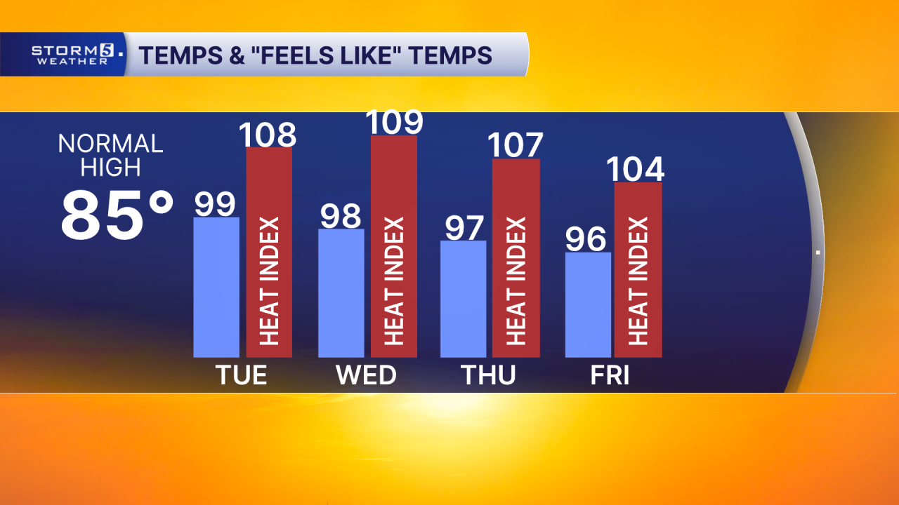
Tuesday: Mostly Sunny & Hot, Record High 98 | High: 99 | S 5-10
Detail:
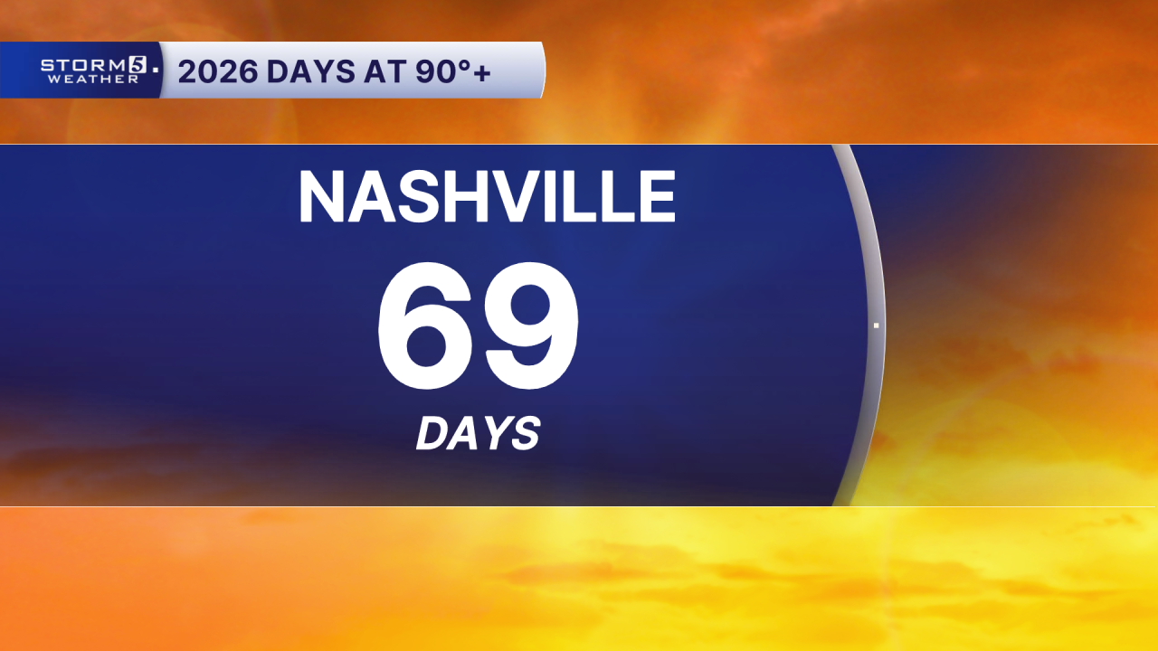
It is HOT! Monday was the 69th day in 2026 with temperatures at or above 90°, including five days reaching 100° or higher...and we’re going to continue adding to that number.
So, where should we be this time of year? Typically, the average high is 85° in Nashville, 83° in Clarksville, and 78° in Crossville.
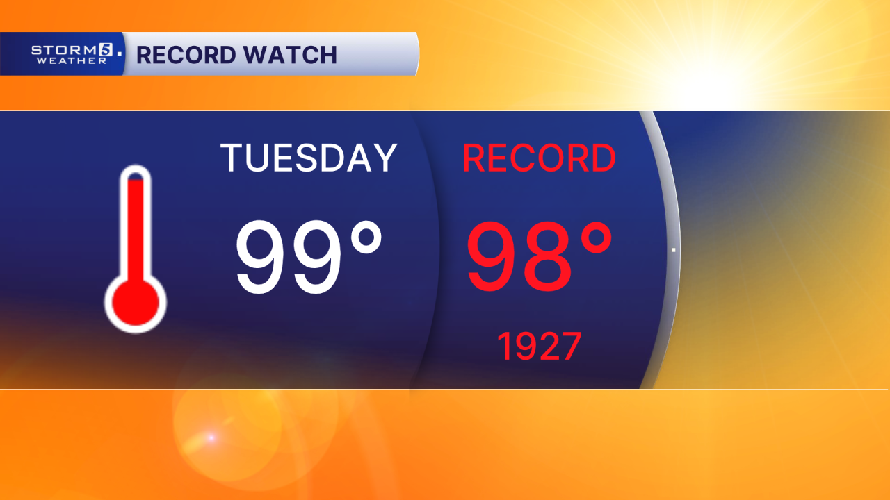
Tuesday could be a day for the record books! The record high is 98° which occurred in 1927 and our forecasted high is 99° for Nashville!
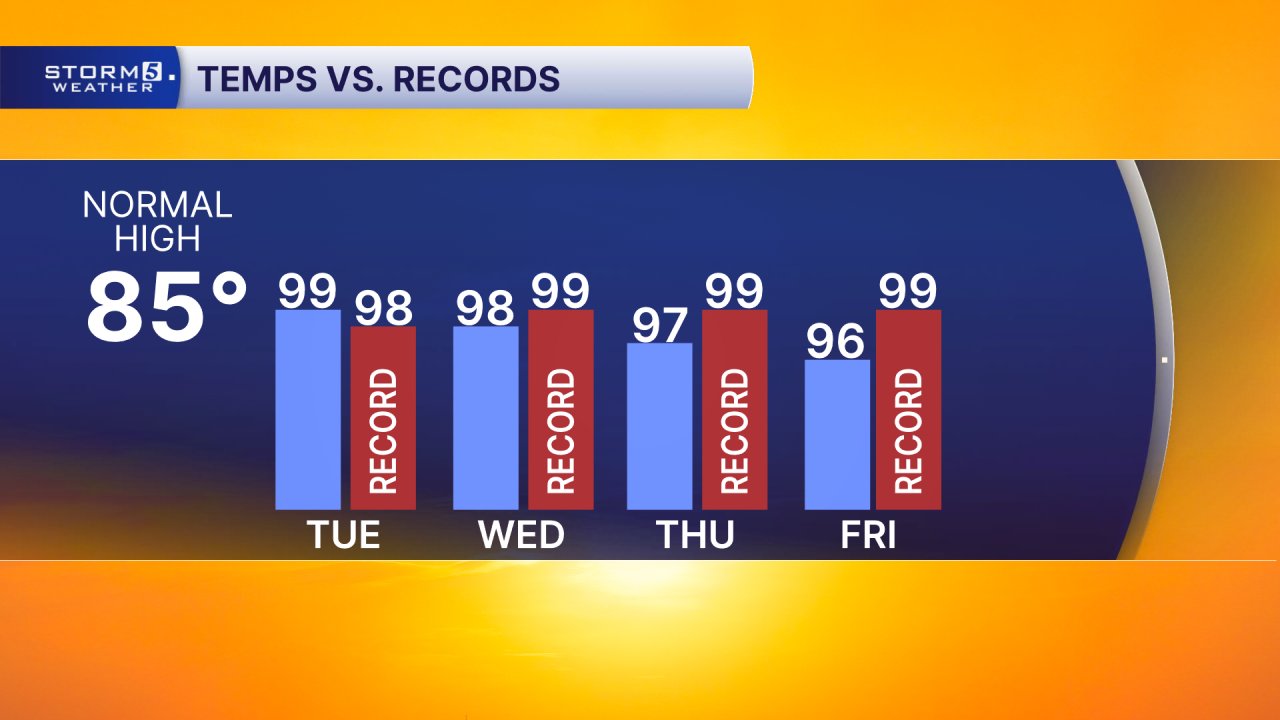
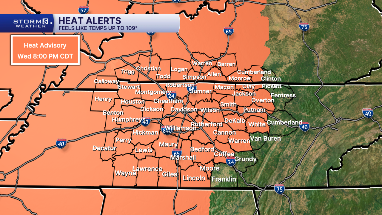
Aside from the chances for reaching a new record high temperatures Tuesday, "feels like" temperatures are forecasted to climb well above the triple-digit mark. Some areas could feel like 109° or higher, prompting a Heat Advisory to go in effect Tuesday morning - lasting until Wednesday evening.