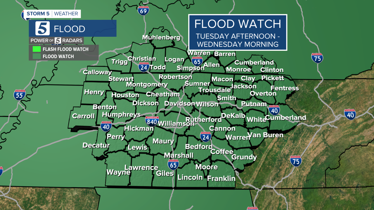
NASHVILLE, Tenn. (WTVF) — While many people have enjoyed the spring-like temperatures the last couple of days, everyone needs to prepare for two rounds of heavy rainfall this week.
Watch below: Meteorologist Henry Rothenberg has the latest on the forecast on Tuesday evening.
The first round will arrive by Monday night through Tuesday evening. A flood watch will go into effect Tuesday afternoon through Wednesday morning for all of the NewsChannel 5 viewing area.

A cold front is pushed through the Mid-South late Tuesday. Ahead of it, a line of storms passed through Middle Tennessee and Southern Kentucky.


Given how much rain we have already seen this year (over 3.5" above average) the ground is already extremely saturated meaning that flooding will be a concern with any of the heavy downpours.
A brief break is expected Wednesday during the daytime before our second round of rain arrives Wednesday night.
This second storm system is set to bring an additional 2-3" of rainfall to the area, bringing more concerns for flooding on Thursday. This could aggravate any flood-prone areas along with creeks and streams that will be swollen from rain earlier this week.

While the current flood watch continues until 12 p.m. Wednesday, it is very likely that another flood watch will be issued for Thursday.
Make sure you have our Storm Shield App downloaded and stick with the Storm 5 Weather team for updates to the forecast this week!


