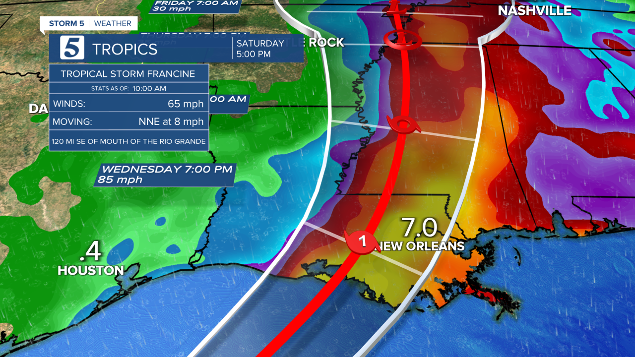
NASHVILLE, Tenn. (WTVF) — Just in time for the peak of hurricane season, all eyes are on the Gulf of Mexico as Francine makes its way toward the Louisiana coast.
Francine is expected to become a hurricane Tuesday afternoon and make landfall in Louisiana sometime between Wednesday afternoon and evening.

The track of the storm has it bringing heavy rain to the Mid-South, and NewsChannel 5 coverage area Thursday into Friday.
While rain is welcome, there are concerns for flash flooding with how dry the ground is, and the heavy amounts of rain anticipated. There is also a low threat we could see a tornado or two Thursday into Friday as the system passes the area.

This is an ever-changing system so stay tuned to the Storm 5 Weather Team for updates over the next several days.

You never know what impact you can have on others — Patsy Montesinos brings us that reminder with a story featuring some very familiar faces. Enjoy this story and go vote for Shante!
- Carrie Sharp


