


NASHVILLE, Tenn. (WTVF) — Mild temperatures are expected to continue for your Wednesday across the Mid-South. However, it is January, and weather like this doesn't last long.

Winds will increase during the day ahead of a storm system that will bring showers and thunderstorms to the area Wednesday afternoon through early Thursday morning. Storms moving from south to north along a cold front will begin impacting western portions of the NewsChannel 5 viewing area around 3:00 p.m. Wednesday afternoon, and likely will not exit until around 6:00 a.m. Thursday morning.
Ingredients are there for a few of these storms to reach strong to severe limits, with damaging wind being the main concern. Because of this, we are calling for a Storm 5 Alert from 3 p.m. Wednesday to 6 a.m. Thursday.

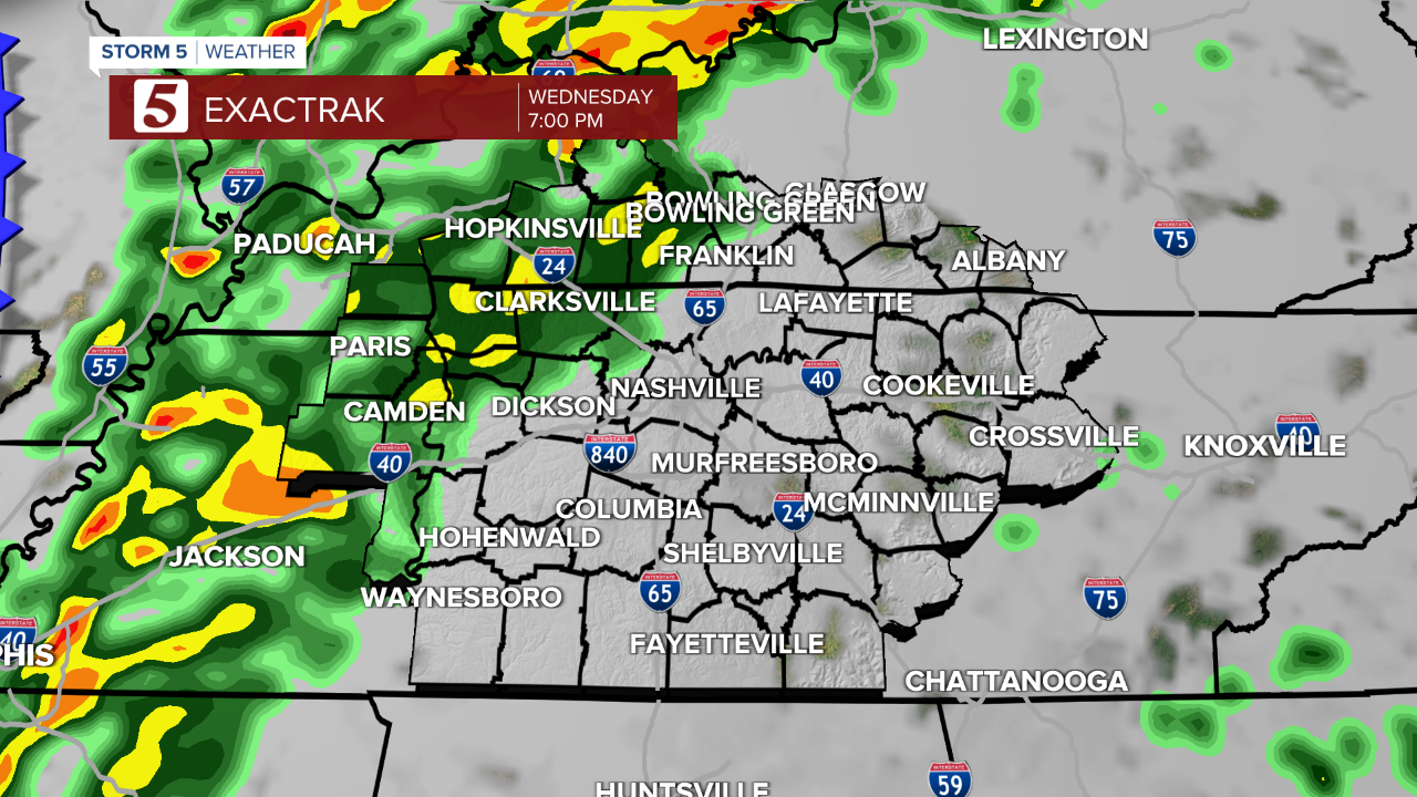
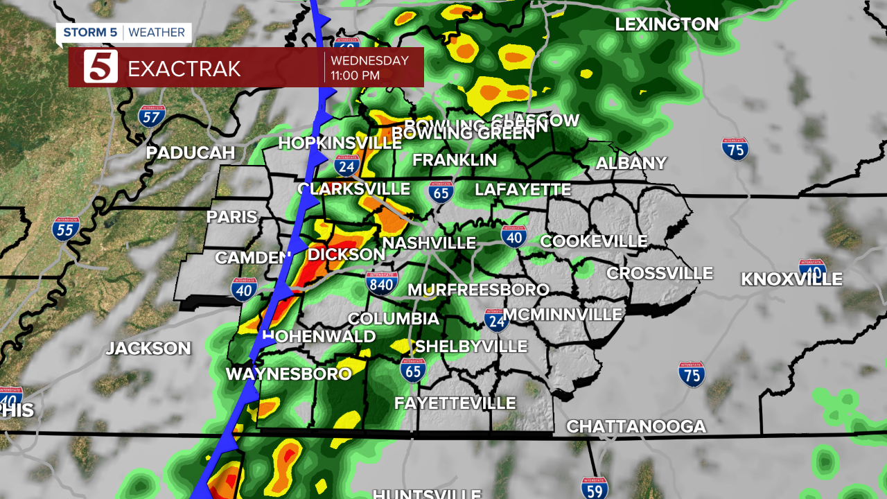

As mentioned, damaging wind is the primary concern with these storms. There is a very low chance for isolated tornadoes and even hail.

A weather radio is a great way to get alerts along with downloading our FREE Storm Shield App to your smartphone.
