The Tennessee Emergency Management Agency has kept the state at a Level III State of Emergency after above-average snowfall blanketed the region.
A Winter Storm Warning was expected to remain in effect for most of Middle Tennessee through Saturday morning. The northern counties received 6-10 inches of snow in less than 12 hours.
Officials with TEMA said there were no reports of fatalities across the state due to the current weather system, despite treacherous driving conditions.
There were two deaths from Wednesday's wintry weather - a 19-year-old Knox County man and an unidentified female in Carter County. Both were killed in vehicle crashes.
Crews with the Tennessee Department of Transportation were still working to clear roadways, coordinating their efforts with local crews out of TEMA regional offices in Jackson, Nashville and Knoxville.
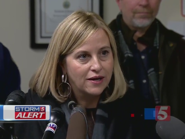
Nashville Mayor Megan Barry spoke at a media briefing Friday afternoon and urged residents to stay home while crews work to clear roadways in the wake of a major snow storm in Davidson County.
Barry spoke from the Emergency Operations Center and said many roads were still treacherous.
“(Our) focus right now (is) primarily on our main arteries, and they are clearing those first. Those secondary streets that you see won’t be cleared until later this weekend so please be safe,” said Berry.
Crews with the Tennessee Department of Transportation were working to clear ramps and roadways; however stranded cars have made that task difficult.
Nashville's snowfall totals of anywhere between 5 to 6 inches would be the highest snowfall since 2003.
As of 3:30 p.m. on Friday, officers with the Metro Nashville Police Department had responded to 229 non-injuriy crashes and 17 crashes with injuries.
At one point, four ambulances were stuck in the snow. One fire truck got stuck in a ditch and two Metro squad cars were involved in fender benders.
Deputy Chief Brian Johnson with Metro Police urged motorists not to leave their cars if possible. If you do have to leave your vehicle, get it out of the road as much as possible or it could get towed.
There were at least 28 Metro Public Works trucks – in addition to TDOT vehicles – working to clear roads.
Officials with the Metro Fire Department said volunteers continued to be dispatched to find stranded motorists. First responders said at one point they had 80 calls pending with no one to send.
The emergency operations office said police and firefighters were driving around on four-wheelers and ATVs to pick up stranded people on major highways.
Emergency warming shelters have also been set up at the Nashville Farmer’s Market.
The system moved into the area much faster than originally expected. By 6 a.m. heavy snow began falling in Metro. Farther north, the precipitation began falling much earlier than that.
The storm has caused a gridlock across the city’s roadways. Portions of I-40 and I-65 near the I-24 split looked like a parking lot – stranding motorists for hours.
The greatest snowfall amounts happened in northwestern counties of the state. Before it’s all said and done, cites like Clarksville, Hopkinsville, Paris and Bowling Green could see 9 inches of snow or greater.
Travel issues could last from Friday well into Saturday as temperatures were expected to remain below freezing until Sunday afternoon.
A statement from the Tennessee Department of Transportation said all 95 counties are stocked up with salt, snow plows and brine trucks are ready to roll and employees are set to mobilize to clear roads of snow and ice.
"We put brine out in the Clarksville area as well as I-40 out toward the Tennessee River because those areas aren't forecasted to get quite as much rain as we are. So we do feel brine will be effective out there," said TDOT officials.
This latest round of wintry weather comes after Wednesday's storm brought up to three inches of snowfall along the Tennessee-Kentucky border. Further south, freezing was more of an issue for many.


